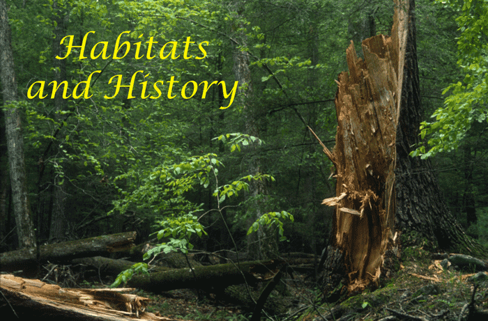
 1) Introduction Habitats and History 1) Introduction Habitats and History
When looking for wildflowers the two major factors that you must consider are the habitat requirements of the species, and the history of the area. If the abiotic conditions, weather, slope, elevation and soil type are not right it is unlikely you will find what you are looking for. But even if all of the physical requirements are met, the species may have been exterminated by past land use practices. In the Shenandoah Valley the most influential of these has been the plow. Many wildflower species are long lived, and can stand the rampages of grazing, or the clear-cutting of the forest, but the plow is designed to kill weeds, and a wildflower is no less a weed than any other. Any process that gets below the surface of the soil and strikes the root can kill the plant. Some of the most diverse sites are on steep hillsides, hillsides that were too steep to plow. Other sites are high in our mountains, above the “plow-line”.
2) Components of Habitats
- a) Abiotic Factors
- i) The two main factors that determine plant distribution are temperature and precipitation. In the horticultural trade we take great notice of plant hardiness zones based on average low temperatures for the past century. The higher sites are often hit by fall and spring ice storms, easily seen by looking at the crowns of the trees. The Humpback Rocks picnic area is filled with chestnut oaks, most exhibiting severe damage to their crowns.
- ii) As a general rule trees require at least 30 inches of precipitation per year, less than that and you have a savanna, or a grassland. In the valley we get 40 to 60 inches, with greater amounts in some valleys. Precipitation is not the only source of moisture, the valley is filled with springs and seeps. Several notable examples are the braided spring at Dripping Rocks (Mile 8 Blue Ridge Parkway) and a rock wall along the Ramsey’s draft trail. Maple Flats in the Big Levels game management area is famous for its sink-hole ponds, and unusual hydrology.
- b) Biotic Factors
- i) Competition with other plants can go beyond simple competition for water or light and include chemical warfare. Hay-scented ferns release chemicals that prevent the germination of other species seeds, as do several tree species (Black Walnut and Cucumber Magnolia).
- ii) Insects and fungal blights have also had dramatic effects on the habitat. The Chestnut Blight, Gypsy moth and Woolly adulgid have all resulted in major shifts in the vegetation present.
3) Role of history
- a) Geologic
- i) The Valley and Ridge Province
- (1) Location - This province separates the eastern United States from the wide flat lands of the mid West. It runs from Lake George in New York, south past Harrisburg, Pennsylvania to Birmingham Alabama. Locally, it is the land west of the Blue Ridge Mountains and continues into West Virginia, where it gives way to the Appalachian Plateau.
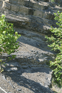 (2) Formation - From 575 to 250 million years BP, this region was repeatedly covered by a shallow sea. During this period, vast amounts of sediment accumulated from decayed marine algae and other organisms. This calcium rich sediment eventually solidified into today’s limestone and dolomite. As the sea level rose and fell the nature of the sediment changed. Inter-layered between the limestones are sandstone and shale, which form under shallow water conditions. As you drive around this region, keep in mind that the tilted beds of rock you see were all laid down on the bottom of an inland sea, and hence were level when they were deposited. The forces produced by the collision of the continental plates were so great that the rock layers in the valley folded and at times they faulted (broke). At the north end of Gypsy Hill Park in Staunton (across from the Tastee Freeze) you can see the broken rock generated by the Staunton - Pulaski fault. The faulting resulted in older layers of rock being shoved up and over other younger layers. This displacement continued for miles to the northwest (Figure 7). The province is filled by a series of parallel folds: the U shaped curves are called synclines and lie between the bulging anticlines. The present valleys formed as a result of over 200 million years of the erosion of soft rock. Rocks with a higher concentration of hard minerals hold the ridges together. This quartz based sandstone and conglomerates form the caps on the ridges. The soft limestone, dolomite and, shale eroded, and formed the valleys. (2) Formation - From 575 to 250 million years BP, this region was repeatedly covered by a shallow sea. During this period, vast amounts of sediment accumulated from decayed marine algae and other organisms. This calcium rich sediment eventually solidified into today’s limestone and dolomite. As the sea level rose and fell the nature of the sediment changed. Inter-layered between the limestones are sandstone and shale, which form under shallow water conditions. As you drive around this region, keep in mind that the tilted beds of rock you see were all laid down on the bottom of an inland sea, and hence were level when they were deposited. The forces produced by the collision of the continental plates were so great that the rock layers in the valley folded and at times they faulted (broke). At the north end of Gypsy Hill Park in Staunton (across from the Tastee Freeze) you can see the broken rock generated by the Staunton - Pulaski fault. The faulting resulted in older layers of rock being shoved up and over other younger layers. This displacement continued for miles to the northwest (Figure 7). The province is filled by a series of parallel folds: the U shaped curves are called synclines and lie between the bulging anticlines. The present valleys formed as a result of over 200 million years of the erosion of soft rock. Rocks with a higher concentration of hard minerals hold the ridges together. This quartz based sandstone and conglomerates form the caps on the ridges. The soft limestone, dolomite and, shale eroded, and formed the valleys.
- ii) The Shenandoah Valley, or Great Valley of Virginia
- (1) Location extends for about 140 miles.
- (2) Formation formed in a region of limestone and dolomite. The solubility of these rocks has played a major role in its evolution. Since the rocks are water soluble, water tends to enlarge and flow rapidly into fractures in the rock, filling the area with sink holes, stream less valleys, and caves (a karst topography).
- iii) The Blue Ridge
- (1) Location - The Blue Ridge runs from Pennsylvania to Georgia, and forms the eastern edge of the Appalachian Mountains. In the Staunton area, the Great Valley separates the Blue Ridge from the Appalachian Plateau. North of the Roanoke River, the Blue Ridge stands alone as a ridge of mountains with subordinate ridges (e.g. Massanutten Mountain) grouped around it, south of Roanoke the valley ceases to separate the Blue Ridge from the rest of the Appalachians. The hills are steep, generally with a slope of over 10%, hence the drainage carves coves or hollows (small valleys) in the sides of the ridges. The Skyline Drive and Blue Ridge Parkway run along the crest of the Blue Ridge Mountains.
- (2) Formation - The Blue Ridge was formed from Precambrian and Cambrian rock that underwent metamorphosis and deformation in the continental collision. Volcanic rocks flowed out of fissures in the ground: this flood basalt was erosion resistant and now forms the top of the Blue Ridge Mountains. For details of their formation see Harris and Tuttle (1983) or Conners (1988).
-
4) Abiotic Conditions in the Ridge and Valley, and Blue Ridge Provinces
- The relationship between elevation, moisture, and topography; to the distribution of forest types was clearly demonstrated by Whittakers work in the Great Smoky Mountains. Conifers are the dominant type on the xeric (dry) sites with Virginia pine at the low elevations grading through pitch pines and finally being replaced by table mountain pine at higher elevations. With increasing moisture the Oaks become the dominants, and finally to the mesic cove hardwood sites.
-
i) Elevation
- The elevation of the region plays a major role in determining the conditions at a given site. Climbing 30 m is equivalent to traveling 30 to 40 km (20-25 miles) northward. Air temperature drops 2.25o F for every additional 1000 ft of elevation, therefore, the peaks of mountains are colder than the surrounding lowlands. This has several effects; the cooler temperatures reduce heat stress and afford a place for northern species of plants and animals to exist well south of their normal range. Cooler temperatures also increase the frequency of ice storms and the trees along ridges will often show signs of storm damage. (Broken branches, twisted trunks, and uniform height). The impact of these changes is demonstrated by the presence of altitudinal zonation. Note due to the small size of the Blue Ridge, the warming influence of the Atlantic Ocean, and the logging activity of man altitudinal zonation is very hard to see in Virginia. This phenomenon was first described in the western United States.
-
ii) Moisture
- Air masses expand and cool when they go over a mountain due to lower atmospheric pressure at higher altitudes. The cooling results in condensation, and increased rain or fog, hence the ridges of mountains tend to receive more direct precipitation than the valleys below. The water does not stay on the ridges but forms a powerful runoff that carries soil and nutrients out of the system and into the valley below. This runoff has cut the valleys and coves in the sides of the mountains. The second highest yearly rainfall in the USA was recorded in the Southern Appalachians, approaching 250 cm (100 in.)/yr. This amount of rainfall is only exceeded on the Pacific Northwest coast. This region has abundant water throughout the growing season, not a rainy and a dry season. Winds coming from the south pick up water from the Gulf, from the east the Atlantic, the North the colder air bring fair weather in the summer but snow clouds from Hudson’s Bay or the Great Lakes in the winter.
-
iii) Slope orientation
- Southern and western slopes get sun all day, and are warmer and drier than the cool, moist northeast facing slopes. Northwest facing slopes are hit harder by winter storms. Locally, chestnut, oak, and Virginia and pitch pine dominate the drier slopes.
-
iv) Type and structure of the bedrock
- The weathering of underlying bedrock forms the soils; certain types of rock produce soil richer in nutrients or of a lower pH than do other types. These factors will also determine which plant species may be found in a given region. For example quartzites are composed of silicon and oxygen, and hence add few minerals, and forming poor-quality soils with low moisture retention. Oaks, pines and azaleas are able to tolerate these conditions. The greenstones and granites are composed of many varied minerals, and hence weather to form a mineral rich soil that supports a greater diversity of plants. Limestones and dolomites also contain a vast store of mineral nutrients and fill the valley with rich soils.
5) Human Impact
-
a) Prior land use-
-
A major human impact in this region is the use of the land. Farm areas that could be plowed were, hence their wildflowers were removed as weeds. Logging for both lumber and tan bark resulted in the clearing of most of eastern N. America. Slash left by loggers along with the trees killed by the Chestnut blight left large amounts of combustible material, and large fires ravaged the area for a long time following the blight.
-
b) Introduced Pests
-
i) Chestnut blight
-
 The chestnut blight was first noticed in 1904 when swollen or sunken cankers were first noticed on the chestnuts at the New York Botanical Garden. It was determined to be a fungus new to man, which was spread by two types of spore, a dry large windblown disk, and a smaller sticky rain dispersed spore. The chestnuts at the Zoo were killed back to the ground by it, and the dangers to the wild chestnuts were beginning to be realized. In 1911 and 1912 Congress appropriated funds to study and combat the disease. In 1913 the disease was found on chestnuts in China, hence proving its oriental origin, and man’s role in its introduction to the US. In Pennsylvania a plan was developed to remove all of the chestnut trees from a mile wide swath across the state, thereby preventing the spread of the windblown spores that were estimated to travel about one half a mile. Before the plan could be put into action the blight jumped the swath, and over 7000 of the smaller spores were found on a single bird. It was now clear that the chestnut was doomed. It took less than forty years for the blight to spread throughout the entire range of the chestnut (Walker 1990). The chestnut blight was first noticed in 1904 when swollen or sunken cankers were first noticed on the chestnuts at the New York Botanical Garden. It was determined to be a fungus new to man, which was spread by two types of spore, a dry large windblown disk, and a smaller sticky rain dispersed spore. The chestnuts at the Zoo were killed back to the ground by it, and the dangers to the wild chestnuts were beginning to be realized. In 1911 and 1912 Congress appropriated funds to study and combat the disease. In 1913 the disease was found on chestnuts in China, hence proving its oriental origin, and man’s role in its introduction to the US. In Pennsylvania a plan was developed to remove all of the chestnut trees from a mile wide swath across the state, thereby preventing the spread of the windblown spores that were estimated to travel about one half a mile. Before the plan could be put into action the blight jumped the swath, and over 7000 of the smaller spores were found on a single bird. It was now clear that the chestnut was doomed. It took less than forty years for the blight to spread throughout the entire range of the chestnut (Walker 1990).
-
ii) Insect herbivores
 Today our forests are being hit by another introduced herbivore, the Gypsy moth. The conifers are being killed by the southern pine bark beetle, which in 1993 had a "good year" in part due to the string of mild winters. The Hemlocks are being killed by the woolly adgelgid, possibly after having been weakened by acid rain. Today our forests are being hit by another introduced herbivore, the Gypsy moth. The conifers are being killed by the southern pine bark beetle, which in 1993 had a "good year" in part due to the string of mild winters. The Hemlocks are being killed by the woolly adgelgid, possibly after having been weakened by acid rain.
-
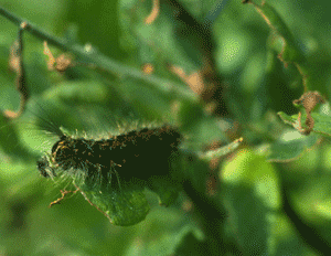
iii) Mammalian herbivoresThe native white-tailed deer and the beaver are also both major factors in shaping biological communities. With hunting limitations in National Parks and Parkways, and increasing areas of surban housing development where hunting is prohibited the impact of the white tailed deer has increased.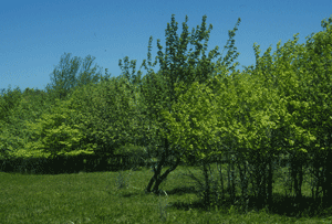 In the picture to the left all of the trees have been grazed to the height that the deer can reach. In the picture to the left all of the trees have been grazed to the height that the deer can reach.
iv) Dogwood Blight
- Dogwood blight is also spreading south. Acid rain has been implicated as a contributing factor in the spread of forest decline due to the reduced forest health making it harder for the trees to resist the attacks of these new pests.
-
c) Direct human intervention.
- Man has the ability to modify the environment to support himself. Both agriculture and the building of cities result in the loss of habitat.
-
i) Agriculture 
- The use of the plow has had long lasting effects on the presence of native species, plows are designed to destroy the root systems of weeds. Recall a weed is any plant growing where some one does not want it to grow, therefore a wildflower growing in a farmers wheat field is a weed.
-
ii) Forestry
- Our need for forest products resulted in the establishment of National and State forests, these areas included land that has become the major source of forested open space in the valley.
-
iii) Urban / suburban development.
- Not only the impact of houses and
 paving but the introduction of cultivated species and the resulting reduction of wooded habitat. paving but the introduction of cultivated species and the resulting reduction of wooded habitat.
-
d) Indirect
-
-
i) Introduction of exotics.
- (a) Exotic species are species that are introduced from another area, most have arrived without their “pests” that would have controlled their population in their country of origin. Many of these are specialists in disturbed areas and quickly take over roadsides and clear-cuts. Some were planted intentionally for erosion control, for example Kudzu and more recently crownvetch and flatpea.
-
ii) Introduction of disease or pests.
 (a) The impact of gypsy moths, and the woolly adulgid has been more on the forest canopy than on the wildflowers beneath, but the changes in light levels following defoliation result in warmer, dryer, and lighter conditions. The shade tolerant species that were growing under the closed canopy are then replaced by faster growing shade intolerant species. (a) The impact of gypsy moths, and the woolly adulgid has been more on the forest canopy than on the wildflowers beneath, but the changes in light levels following defoliation result in warmer, dryer, and lighter conditions. The shade tolerant species that were growing under the closed canopy are then replaced by faster growing shade intolerant species.
-
iii) Impact of browsing by deer.
 The white tailed deer is a browser, and a native of our forest margins. With the removal of its native predators deer populations have increased. With hunting limitations in National Parks and Parkways, deer populations have reached extreme numbers. A woodland exposed to pressure from deer takes on a new shape, in extreme cases all branches are bitten off as high as the deer can reach. The white tailed deer is a browser, and a native of our forest margins. With the removal of its native predators deer populations have increased. With hunting limitations in National Parks and Parkways, deer populations have reached extreme numbers. A woodland exposed to pressure from deer takes on a new shape, in extreme cases all branches are bitten off as high as the deer can reach.
6) Disturbed areas
-
a) Fires
 Fire is a natural part of the ecosystem, human’s control of fire and fire suppression is not. The result has been fewer and more intense fires that have a greater impact. Frequent fire reduces the litter to the point that there is not enough material to burn the trunks of mature trees. When fires are suppressed fallen branches build up and soon the forest floor has enough material to fuel an intense fire. Fire is a natural part of the ecosystem, human’s control of fire and fire suppression is not. The result has been fewer and more intense fires that have a greater impact. Frequent fire reduces the litter to the point that there is not enough material to burn the trunks of mature trees. When fires are suppressed fallen branches build up and soon the forest floor has enough material to fuel an intense fire.
-
b) Floods
 Flooding is a natural part of the cycle, and in wilderness areas has been impacted little by man. In areas that have been urbanized the increased paved surfaces have resulted in faster run off and increased damage due to flooding. Flooding is a natural part of the cycle, and in wilderness areas has been impacted little by man. In areas that have been urbanized the increased paved surfaces have resulted in faster run off and increased damage due to flooding.-
c) Clear-cuts
- Land must make a profit, and much of the Shenandoah Valley that is forested exists as part of the National Forest System. As such it must provide the wood products required by the paper and building industries. A clear cut mimics an area that was burned by a wildfire, and provides for a greater variety of species than an unbroken forest.
-
d) Farm Fields
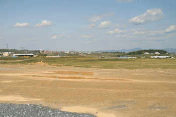
- Farming provides open space, and pastures and fencerows may provide a refuge for wildlife. For a hedgerow to be of any real value it should be at least 30 - 40 feet deep, unfortunately this results in a measurable reduction of harvestable area. The result is that few hedgerows remain as can be seen in this picture taken in Swoope VA.
-
-
-
-
7) Habitats of the Shenandoah Valley
- i) Note: unlike the “greenhouse” effect, the Pleistocene climactic changes were slow: occurring over thousands of years, giving tree species time to migrate. For a tree species to shift its range its seeds must be transported past the edge of its current range, grow to maturity, and produce seeds, which must then be transported out of the current range again. This is a very slow process. The concern about greenhouse climate changes (even if they take hundreds of years) is that the migration of tree species takes thousands of years and many species would be left behind by a roving climate.
- ii) Unlike the forests to the north, the glaciers never scraped Virginia clean, leaving some forests to experience 200 million years of continuous growth. When the Pleistocene glaciations occurred many northern species were forced to move south with the climate that they were best adapted to. The area south of the ice sheets became a refugium for the northern species. As the glaciers retreated the newly exposed land was recolonized from the stock of species that had taken refuge in the Appalachians. The general warming of the climate caused those species of northern affinity to loose out in competition with southern species in the warmer valleys. Northern species survive today on the higher peaks, Spruce Knob and the Dolly Sodds in West Virginia and Stony Man mountain on the Blue Ridge and on cool moist sites, like Laurel Springs and Crab Tree Falls. Either lower temperatures, or an abundance of water to counteract warmer temperatures, appear to be necessary for the survival of relic northern species. Augusta County has species of both northern and southern affinity. Many northern species are at the southern extent of their range, and conversely, many southern species are at the northern limit of their ranges. The term hinge is applied to these regions of overlap between northern and southern species.
- b) Biotic Communities of the Ridge and Valley, and Blue Ridge Provinces
-
i) Chestnut Oak Forests
- Found on dry sunny ridges, composed of chestnut oak, red oaks, hickories and pines. Understory dominated by dogwood, mountain laurel, and striped maple.
-
ii) Red Oak Forests
- Found on moister slopes: sides of a valley, between dry ridges and moist valley bottoms. Sparse understory vegetation, thus easy to walk through.
-
iii) Cove Hardwoods - Red Oak - Ash - Basswood Forest
- Found on moist sites, youthful valley stream bottoms etc. Best development on wetter sites in the Southern Appalachians (up to 250 cm (100 inches) of rain fall / year). Consists of hemlock, white pine, birch, sycamore and maple. Great diversity of species, over 20 tree species have been found in the canopy alone, and in some areas of the Southern Appalachians, the number of different plant species exceeds 400. Understory of striped maple, spicebush, hop hornbeam, eastern red bud, sassafras and witch hazel. The presence of basswood and tulip (yellow poplar) trees helps to distinguish this forest type from the oak-hickory forest.
-
iv) Tulip (Yellow Poplar) Forest
- Found downstream from the cove forests, Yellow poplars rising to 40 meters (120 feet), along with various oaks, white ash, birch, sycamore, alder, willow, sugar maple. Understory of striped maple, spicebush, and maples.
-
v) Hemlock Forest
- Found in cool moist environments; groves remain only where the loggers missed them, or the terrain was too rugged for the loggers to attempt to get out. Commonly found yellow birch, white pine, red oak, and basswood are commonly found with them. In dense stands, the understory is reduced to an herbaceous layer of nothing.
-
vi) Pine and Oak-Pine Forest
- Found on warm dry southwest facing slopes, especially if the slopes are covered with thin poor sandy soil, which is derived from quartz-rich rocks. Virginia Pine and Pitch pine alone or in association with bear oak, Blackjack oak, chinquapin oak, and possibly eastern red cedar. Understory very dense composed of mountain laurel, blue berries, and possibly scrub oaks. This type of forest comes in after logging. The pines are able to withstand dry conditions, but are shade intolerant, hence will give way to the oaks, unless fire or some other factor keeps the oaks in check.
-
vii) Transition Forest
- Found in the overlap zone between the northern coniferous forest, reaching its southern limit here, and the Oak-Hickory forest. Where two distinct forest types mingle, they form a unique community. Found between northern and southern extremes of the two forest types, and between high and low zones in the Appalachians. At the peaks spruce fir dominates, and at the base oak-hickory. The transition forest falls in between.
8) Temperate deciduous forest – Primary Succession
 Succession is an orderly progression from bare rock to forest. Succession is broken into two distinct phases, primary succession where there is no soil present at the start, and secondary succession. Primary succession is what takes place on rock outcrops, boulders and any other place the soil has been swept away. It is a description of the series of events that results in the development of a soil layer on top of the rock. Secondary succession follows the abandonment of a farm field, or the recovery from a wildfire or flood. In secondary succession seeds and root fraqgments are normaly present in the soil at the start of the succession. In the latter two examples if all of the soil has been removed primary succession will occur. Along our ridges rock outcrops provide ideal sites to view primary succession. Succession is an orderly progression from bare rock to forest. Succession is broken into two distinct phases, primary succession where there is no soil present at the start, and secondary succession. Primary succession is what takes place on rock outcrops, boulders and any other place the soil has been swept away. It is a description of the series of events that results in the development of a soil layer on top of the rock. Secondary succession follows the abandonment of a farm field, or the recovery from a wildfire or flood. In secondary succession seeds and root fraqgments are normaly present in the soil at the start of the succession. In the latter two examples if all of the soil has been removed primary succession will occur. Along our ridges rock outcrops provide ideal sites to view primary succession.
-
 A rock surface provides a harsh environment for plants to become established. The surface of the rock will offer little moisture retention, and a difficult substrate for a seed to adhere to. The first colonizers of bare rock are often lichens, spreading by microscopic spores that are able to catch-hold on the smooth surface of the rock. Lichens are a classic example of symbiosis being an association between an algae and a fungus, in which the cells of the fungus provide a habitat in which the algae can survive, and in return the algae carries on photosynthesis thereby feeding the fungus. The covering of lichens increases the texture on the surface of the rock thereby speeding up the rate at which a soil layer accumulates. Windblown organic debris that would be blown or washed off of a rock may become entangled in the thallus growth of the lichen. A rock surface provides a harsh environment for plants to become established. The surface of the rock will offer little moisture retention, and a difficult substrate for a seed to adhere to. The first colonizers of bare rock are often lichens, spreading by microscopic spores that are able to catch-hold on the smooth surface of the rock. Lichens are a classic example of symbiosis being an association between an algae and a fungus, in which the cells of the fungus provide a habitat in which the algae can survive, and in return the algae carries on photosynthesis thereby feeding the fungus. The covering of lichens increases the texture on the surface of the rock thereby speeding up the rate at which a soil layer accumulates. Windblown organic debris that would be blown or washed off of a rock may become entangled in the thallus growth of the lichen.
-
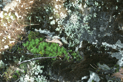 As organic debris becomes entangled a soil layer begins to form and mosses begin to invade the rocks surface. The increasing depth of the organic layer on the rocks surface increases the moisture levels at the rock surface, this in turn results in a wetter rock surface. Surface moisture freezes and thaws in the winter resulting in increased erosion of the rocks surface, and adding the depth of the soil layer. Vines will often invade from the sides of the outcrop, and become established in the cracks of the rocks. As organic debris becomes entangled a soil layer begins to form and mosses begin to invade the rocks surface. The increasing depth of the organic layer on the rocks surface increases the moisture levels at the rock surface, this in turn results in a wetter rock surface. Surface moisture freezes and thaws in the winter resulting in increased erosion of the rocks surface, and adding the depth of the soil layer. Vines will often invade from the sides of the outcrop, and become established in the cracks of the rocks.
9) Forest communities
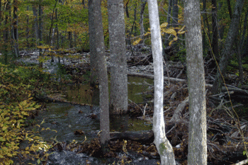
- a) Middle River Floodplains
-
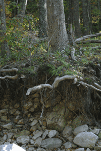 Floodplains are the areas adjacent to rivers where spring flooding often sweeps the litter from the forest floor and deposits rich sediments. They are moist communities receiving water not only from the river but also from the gravity directed flow of runoff into them with every precipitation event. On the banks adjacent to the river the tree’s roots are often undercut resulting in the tree falling up stream in a flood. This may form a temporary dam if the top of the tree lodges on the opposite bank. When this occurs the river will overflow it’s banks and depending on the nature of the bank beside the old channel may form a new channel. A careful examination both the St. Mary’s River and Ramsey’s Draft wilderness areas will reveal many past river courses. Floodplains are the areas adjacent to rivers where spring flooding often sweeps the litter from the forest floor and deposits rich sediments. They are moist communities receiving water not only from the river but also from the gravity directed flow of runoff into them with every precipitation event. On the banks adjacent to the river the tree’s roots are often undercut resulting in the tree falling up stream in a flood. This may form a temporary dam if the top of the tree lodges on the opposite bank. When this occurs the river will overflow it’s banks and depending on the nature of the bank beside the old channel may form a new channel. A careful examination both the St. Mary’s River and Ramsey’s Draft wilderness areas will reveal many past river courses.
-
-
- The soil on these flood plains is often composed of the not only fine humus, but the fine sands and clays that were swept from the river channel and deposited as the current slowed as the flood receded. Following floods secondary succession takes place as the banks of the river and newly formed bars in the channel are revegetated. The river itself provides a light gap in the forest canopy and increases the productivity of the stream bank. They often serve as an ecotone between the water and the land and hence are prized for their diversity.
-
-
i) Bald Rock
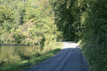 Bald Rock just north of Verona and the Frank’s Mill area are examples of floodplains where a steep hillside comes down to the river on one side and it is open on the other. Both are excellent wildflower sites since the hillsides are too steep to plow and the land has yet to be developed. The river has cut into the rock, and the bank has been widened to allow the road to remain beside the river. The river is wide enough to provide a light gap (a treeless space through which light flows to the forest floor) such that the banks of the river are sunny. Many of the species that have come in to these areas are exotic, such as Japanese Honeysuckle and garlic mustard, and they make use of the disturbance caused by road maintenance activities and seasonal flooding. A quick glance at the trees along the bank will reveal dead leaves caught in the lower branches. This is a tell tale sign of the heights of past floods. Bald rock provides a seasonal show of wildflowers starting with hepatica in late March, toad trillium, wild ginger and Dutchman's Breeches by late April and then as fall arrives Great Lobelia and wild Monkshood take over. Bald Rock just north of Verona and the Frank’s Mill area are examples of floodplains where a steep hillside comes down to the river on one side and it is open on the other. Both are excellent wildflower sites since the hillsides are too steep to plow and the land has yet to be developed. The river has cut into the rock, and the bank has been widened to allow the road to remain beside the river. The river is wide enough to provide a light gap (a treeless space through which light flows to the forest floor) such that the banks of the river are sunny. Many of the species that have come in to these areas are exotic, such as Japanese Honeysuckle and garlic mustard, and they make use of the disturbance caused by road maintenance activities and seasonal flooding. A quick glance at the trees along the bank will reveal dead leaves caught in the lower branches. This is a tell tale sign of the heights of past floods. Bald rock provides a seasonal show of wildflowers starting with hepatica in late March, toad trillium, wild ginger and Dutchman's Breeches by late April and then as fall arrives Great Lobelia and wild Monkshood take over.-
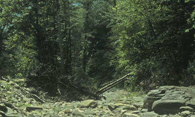
ii) Ramsey’s Draft
 The Ramsey’s Draft wilderness area contains a large number of trails through a variety of habitats. The Ramsey’s Draft trail follows the draft through some of the richer mesic forests in the area. The Hemlock Wooly Adulgid, and Pine Bark Beetle have had a major impact on the forest. The greatest tree mortality seems to have occurred along the flood plain where flooding may have damaged tree root systems and the trees were then weakened before the insect attacks. The Ramsey’s Draft wilderness area contains a large number of trails through a variety of habitats. The Ramsey’s Draft trail follows the draft through some of the richer mesic forests in the area. The Hemlock Wooly Adulgid, and Pine Bark Beetle have had a major impact on the forest. The greatest tree mortality seems to have occurred along the flood plain where flooding may have damaged tree root systems and the trees were then weakened before the insect attacks.
-
-
iii) 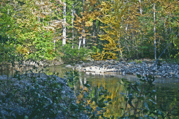 St. Mary’s Wilderness St. Mary’s Wilderness
-
- The Saint Mary's Wilderness area follows the St. Marys River to its source. Starting out in a Tulip dominated bottom and progressing up the valley thru a Hemlock community and ending with the ridgetop oak forest on the top of Mine Bank Mountain. The trail follows an old mine road, but in recent years the river has changed course on several occasions and the trail has been reduced to a ledge along the edge of the river.
-
-
iv) 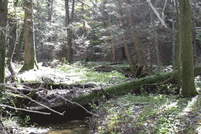 Chimney Hollow Chimney Hollow
The Chimney Hollow trail starts at US route 250 and climbs to the summit of Crawford Mountain. The change in elevation is from 1900 feet at it start along route 250 to 3643 feet on the summit.
-
-
b) Ridge Top Communities
- Ridge top communities are exposed to the harshest conditions of any of our local habitats. The increased elevation results in ice storms in the spring and fall. These ice storms prune the trees, breaking of large numbers of branches and keeping the canopy more open for the forest floor plants. Precipitation drains from the ridges, and exposure to wind increases evapotranspiration rates. The result is that many ridge-top communities are much drier that communities that are down slope from them.
-
-
- iii) Dowell’s Draft
-
- Dowell's Draft winds up the western side of Hankey Mountain passing a large wildlife clearing.
-
- c) Old fields early successional stages
-
- When a field is abandoned, or a forest is swept clear by logging or fire an orderly series of changes occurs as the area is revegetated. The pioneer species that arrive first are normally either wind blown or have the ability to lie dormant in the soil for decades, germinating when the conditions change. At first a cover of herbaceous plants and grasses will hold forth, these eventually replaced by shrubs and small trees. Eventually light loving trees will get established and shade out the earlier species.
-
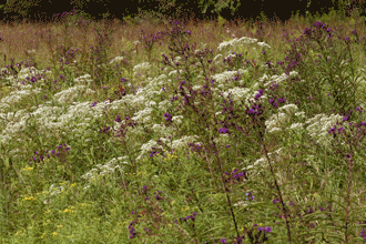
- i) Cow Bane Prairie
-
Prairies are grasslands historically kept clear of brush by grazers, elk, deer and buffalo, and by the regular burning by Indians. The Shenandoah Valley was a vast grass prairie at the time of European settlement, and Indians used fire frequently to modify the forest ecosystem to make it easier to hunt and raise crops70
-
-
-
- ii) Roadsides in the valley
- The valley has many open areas, some abandon farms, and other areas with wide right-of-ways that have become a haven for old field species. Many of these evolved to withstand grazing, so the occasional meeting with a mower does not destroy them, it simply prevents a shrub stage from taking over.
-
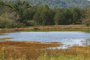
- iii) Augusta Springs
-
- The Augusta Springs wildlife viewing area is on the site of a former spring water bottling business. A board walk takes you across a naturally wet area.
|
|
 i) Humpback rocks